GEOTECHNICALENGINEERING
VICTORIA BC
HomeGeophysicsElectrical resistivity / VES (Vertical Electrical Sounding)

Electrical Resistivity Testing & VES Surveys in Victoria BC

Technical studies that support your project.

LEARN MORE

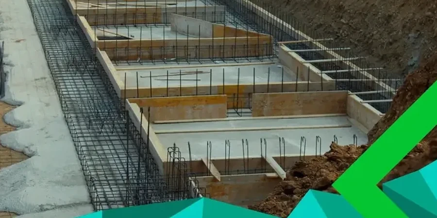
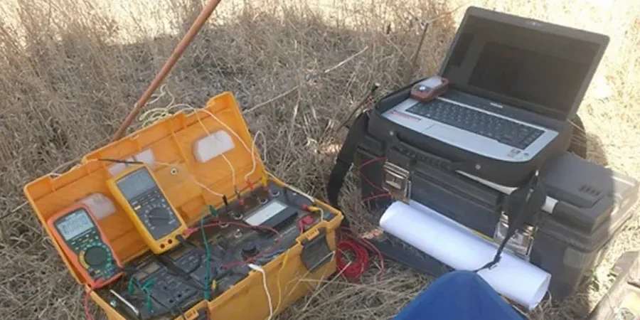
A four-electrode array stretches across a glaciated slope in Saanich—stainless steel stakes driven into damp till, a resistivity meter clicking through programmed measurement cycles. That's a typical field setup for a Vertical Electrical Sounding campaign in Victoria, where the Cordilleran ice sheet left behind a complicated layering of till, marine clay, and outwash. The instrument injects a controlled DC or low-frequency AC current through the outer electrodes while the inner pair measures the resulting potential difference; the ratio yields apparent resistivity, and as electrode spacing expands, current penetrates deeper. In Victoria's post-glacial terrain—think the Victoria Clay beneath James Bay or coarse outwash gravels near UVic—the method separates conductive silts from resistive bedrock without a single drill hole. The resistivity curve is then inverted with software that accounts for the city's characteristic three- and four-layer models.
When borehole control is available nearby, we tie the VES interpretation to lithology logs for calibrated depth-to-bedrock maps. Our field crew has run these lines from Langford to Oak Bay and knows how the local geology—and urban stray currents—affect data quality.

A single VES sounding in Victoria can distinguish between dry granular outwash and saturated marine clay before a shovel breaks ground—that's the value of non-invasive resistivity profiling in post-glacial terrain.

Our service areas

Methodology and scope

Victoria's development arc from Fort Victoria trading post to modern seismic-design city has stacked infrastructure onto a subsurface that ranges from competent metamorphic bedrock of the Wrangellia terrane to compressible estuarine deposits around the Gorge Waterway. That history creates a specific geotechnical demand: knowing what lies beneath before excavation or foundation design begins. Electrical resistivity fills the gap by profiling these contrasts non-invasively. A VES sounding near the Inner Harbour might track the bedrock depression beneath Victoria's marine clay, while a 2D resistivity line along a proposed trench alignment maps fracture zones in basalt. The data are processed in our ISO/IEC 17025 accredited laboratory with inversion routines that honour local resistivity ranges—typically 5-50 Ω·m for saturated clay, 100-800 Ω·m for glacial till, and more than 1000 Ω·m for fresh bedrock.
For projects where resistivity anomalies need ground-truthing, we often combine the survey with a targeted test pit program, excavating at low-resistivity zones to confirm saturated clay thickness. On larger linear infrastructure, a preliminary MASW survey run along the same profile provides shear-wave velocity that complements the resistivity cross-section for a full geophysical picture.
Electrical Resistivity Testing & VES Surveys in Victoria BC
Technical reference — Victoria BC

Local geotechnical context

The coastal humidity and persistent winter rains of southern Vancouver Island do more than keep Victoria green—they saturate the upper soil column and alter resistivity contrasts in ways that can fool a poorly calibrated interpretation. A dry summer profile of glacial till shows high resistivity; the same material after a November rain event reads significantly lower. Our processing corrects for seasonal moisture effects by referencing climate-normalized soil resistivity curves developed from multi-year datasets in the Capital Regional District. Saltwater intrusion along the waterfront adds another layer of complexity: conductive saline pore fluid in the Victoria Clay can mimic the resistivity signature of a deeper saturated layer. Without petrophysical calibration, the depth-to-bedrock estimate could be off by several metres. The risk is real. A misinterpreted VES curve in Victoria's near-shore zones can lead to excavation overruns when bedrock appears deeper than predicted—or worse, a foundation bearing on what was assumed to be competent till that is actually compressible clay. We address this by running calibration soundings adjacent to existing borehole logs and using constrained inversion that incorporates geological boundaries mapped by the Geological Survey of Canada.

Need a geotechnical assessment?

Reply within 24h.

Email: [email protected]

Regulatory framework

NBCC 2020 (National Building Code of Canada) — geotechnical investigation requirements for seismic site class determination, CSA A23.3 — design of concrete structures, referencing subsurface investigation parameters, ASTM D6431-18 — standard guide for using the direct current resistivity method for subsurface site characterization, ISO/IEC 17025 — general requirements for the competence of testing and calibration laboratories, BC Building Code 2018 — Section 9.4 structural design and geotechnical investigation provisions

Typical values

ParameterTypical value
Electrode arraySchlumberger and Wenner configurations
Maximum investigation depthTypically 30 to 60 m, depending on surface geometry
Measured parameterApparent resistivity (Ω·m) vs. AB/2 electrode spacing
Data inversion1D layered-earth models, smoothed-constraint Occam inversion
Quality controlRepeatability checks at crossover AB/2 spacings; contact resistance <2 kΩ
Laboratory accreditationISO/IEC 17025 for geophysical data processing and reporting
Reporting standardCSA A23.3 and NBCC 2020 geotechnical data requirements
Typical site areaFrom single-point soundings to multi-kilometre 2D tomography lines

Questions and answers

How deep can a VES survey investigate in Victoria's glacial soils?

Depth of investigation depends on the maximum electrode spacing achievable on site and the subsurface resistivity structure. With a Schlumberger array using AB/2 spacings up to 100 m, investigation depths of 30 to 50 m are typical in Victoria's glacial till and clay. Deeper penetration is possible on large open sites, though urban constraints in neighbourhoods like James Bay or Fairfield often limit maximum spread length. The technique resolves well the contact between conductive Victoria Clay and resistive metamorphic bedrock, which is the primary target for most geotechnical applications.

What is the cost of an electrical resistivity survey in Victoria BC?

For a standard VES sounding with full data processing and interpretation, budget between CA$980 and CA$1,410 per survey point. A 2D resistivity tomography line typically falls in a comparable range per linear metre, though pricing varies with array length, electrode count, and site accessibility. We provide a firm quote after reviewing the site location, depth target, and any urban interference factors such as buried utilities or overhead power lines.

Can resistivity surveys replace boreholes for site investigation in Victoria?

Resistivity surveys complement boreholes but do not replace them entirely. The method provides continuous subsurface profiles between borehole locations and can identify anomalies that discrete drilling might miss. However, resistivity data require ground-truth calibration—a borehole or test pit at a key location converts resistivity values into lithology with confidence. On Victoria projects we typically recommend a phased approach: initial resistivity profiling to optimize borehole placement, followed by targeted drilling at zones of geophysical interest.

How does saltwater intrusion affect resistivity measurements near Victoria's waterfront?

Saltwater intrusion along the Victoria waterfront and the Gorge Waterway significantly depresses formation resistivity, with saturated clay values dropping to 1-5 Ω·m in some areas. This can mask deeper resistivity contrasts and complicate bedrock depth interpretation. Our processing uses constrained inversion that incorporates known porewater salinity data from monitoring wells and applies a correction based on Archie's law relationships calibrated for the Victoria Clay. We also run calibration soundings adjacent to sites with existing lithological control to verify the petrophysical model.

Location and service area

We serve projects in Victoria BC and surrounding areas. More info.

View larger map